The supercell, on radar
Mesocyclone, BWER, rear-flank downdraft — what a rotating updraft does to the data.
A supercell is defined by one thing: a persistently rotating updraft. Not size, not severity, not whether it produces a tornado. Every other feature on this page is a consequence of that rotation.
It is also the storm type that produces nearly all violent tornadoes, most giant hail, and the structures that make radar interpretation worth learning.
The mesocyclone
The rotating updraft itself, typically 2–6 miles across and extending through a substantial depth of the storm.
In reflectivity it is often invisible. You may infer it from a hook or an inflow notch, but rotation does not directly change how much energy comes back.
In velocity it is unmistakable: inbound beside outbound, persistent, and present across multiple elevation cuts. Depth is what separates a mesocyclone from transient noise. A circulation that appears at 0.5°, again at 1.5°, and again at 2.4° is a column of rotating air, not an artifact.
Not every mesocyclone produces a tornado — a substantial majority do not. What it establishes is that the storm is organized, likely to persist, and capable.
The BWER — the best structural evidence there is
The bounded weak echo region is the most compelling thing radar shows you, and it is nearly impossible to see properly in a flat 2D image.
The physics: in a violently rotating updraft, air rises so fast that precipitation cannot form or fall inside the updraft core. Hydrometeors are carried up and thrown outward. The result is a column of low reflectivity, surrounded on all sides and capped above by high reflectivity — a vault.
It is “bounded” because the weak echo is enclosed. In a single low tilt it may look like a notch, or like nothing. Stepping up through elevations, you find weak returns at low levels with a strong echo overhang above them.
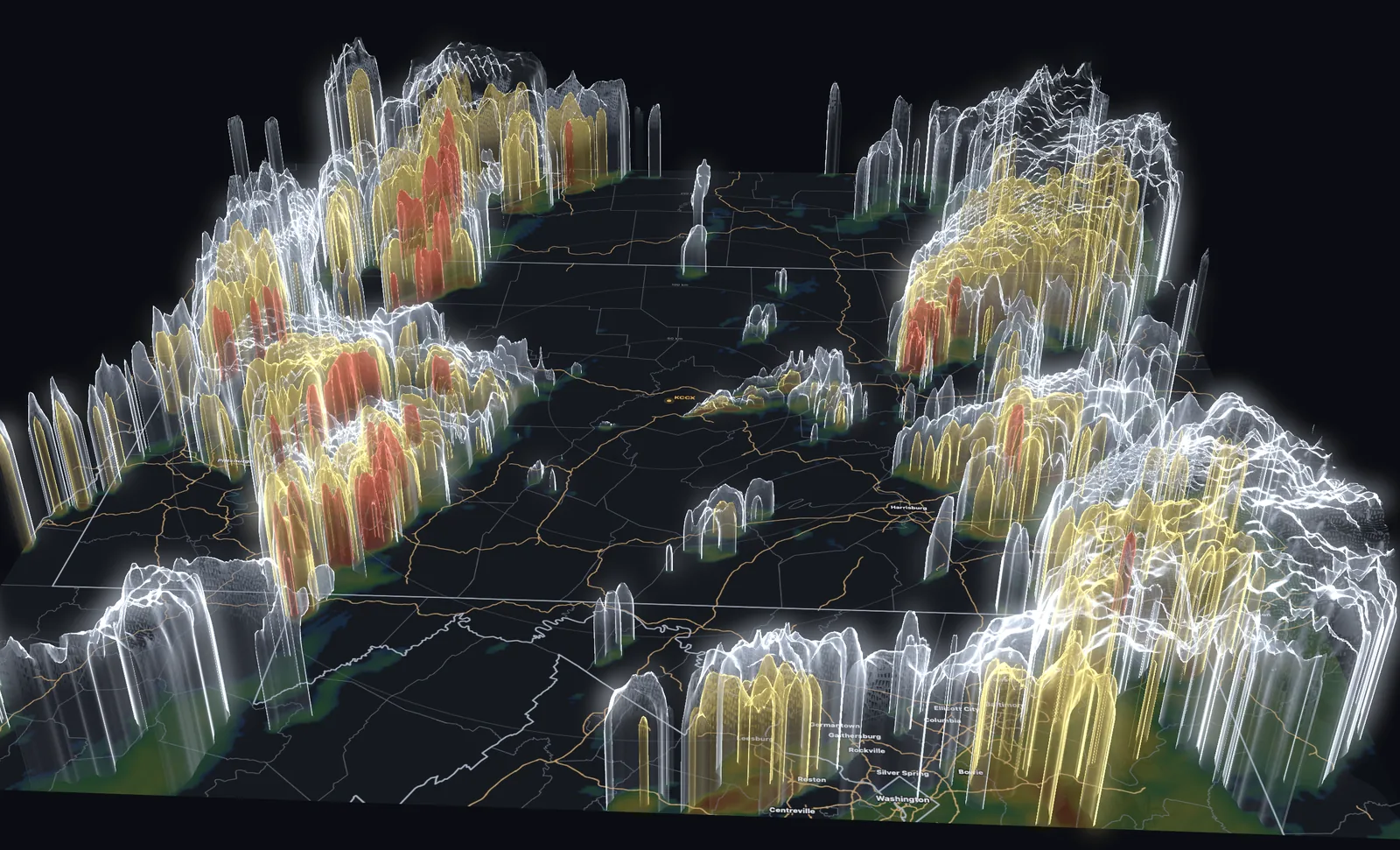
A BWER means the updraft is strong enough to suspend precipitation against gravity. That is a direct observation of updraft intensity, and it is exactly the kind of three-dimensional structure that a stack of flat tilts describes badly and a volumetric rendering shows immediately.
Echo overhang and the forward-flank downdraft
Above and ahead of the BWER sits the echo overhang — high reflectivity aloft with weak returns beneath, where precipitation formed in the updraft is carried downwind before it can fall.
The forward-flank downdraft is where that precipitation finally does fall, producing the broad reflectivity shield on the storm’s forward side. Along its boundary with the inflow lies a temperature gradient that contributes to the storm’s low-level rotation.
The rear-flank downdraft
The RFD wraps around the back of the mesocyclone: descending, often drier air curling cyclonically around the circulation. This is what carves the hook — the RFD wrapping precipitation around the rotation. A clearing slot behind the hook, where reflectivity thins as dry air wraps in, is the RFD becoming visible.
RFD behavior is closely tied to tornadogenesis. Current understanding holds that the buoyancy of the RFD air matters: a relatively warm RFD favors a tornado, while a cold dense one tends to undercut the circulation and kill it. Radar cannot measure that temperature. It is a hard limit on what the data can tell you, and one reason apparently identical storms behave differently.
The wall cloud
Worth being precise about: the wall cloud is a visual feature, not a radar one. It is a lowering of the cloud base beneath the rain-free base, marking where rain-cooled air is drawn into the updraft and condenses at a lower level. A persistent, rotating wall cloud is among the most significant things a trained spotter can report.
Radar shows you the circulation the wall cloud hangs beneath. It does not show you the wall cloud. Spotter reports and radar answer different questions, which is why the warning process uses both.
The three-body scatter spike
A radar artifact that is genuinely useful. When the beam strikes very large hail, some energy scatters down to the ground, reflects back to the hail, and only then returns to the radar. That longer path makes the radar place the return farther away than it should be, producing a spike of weak echo extending radially behind the core.
A TBSS is essentially only produced by very large hail. It is an artifact that constitutes evidence — and because it appears only along the radial, it is a standing reminder that radar geometry is always present in what you see.
Classic, HP and LP
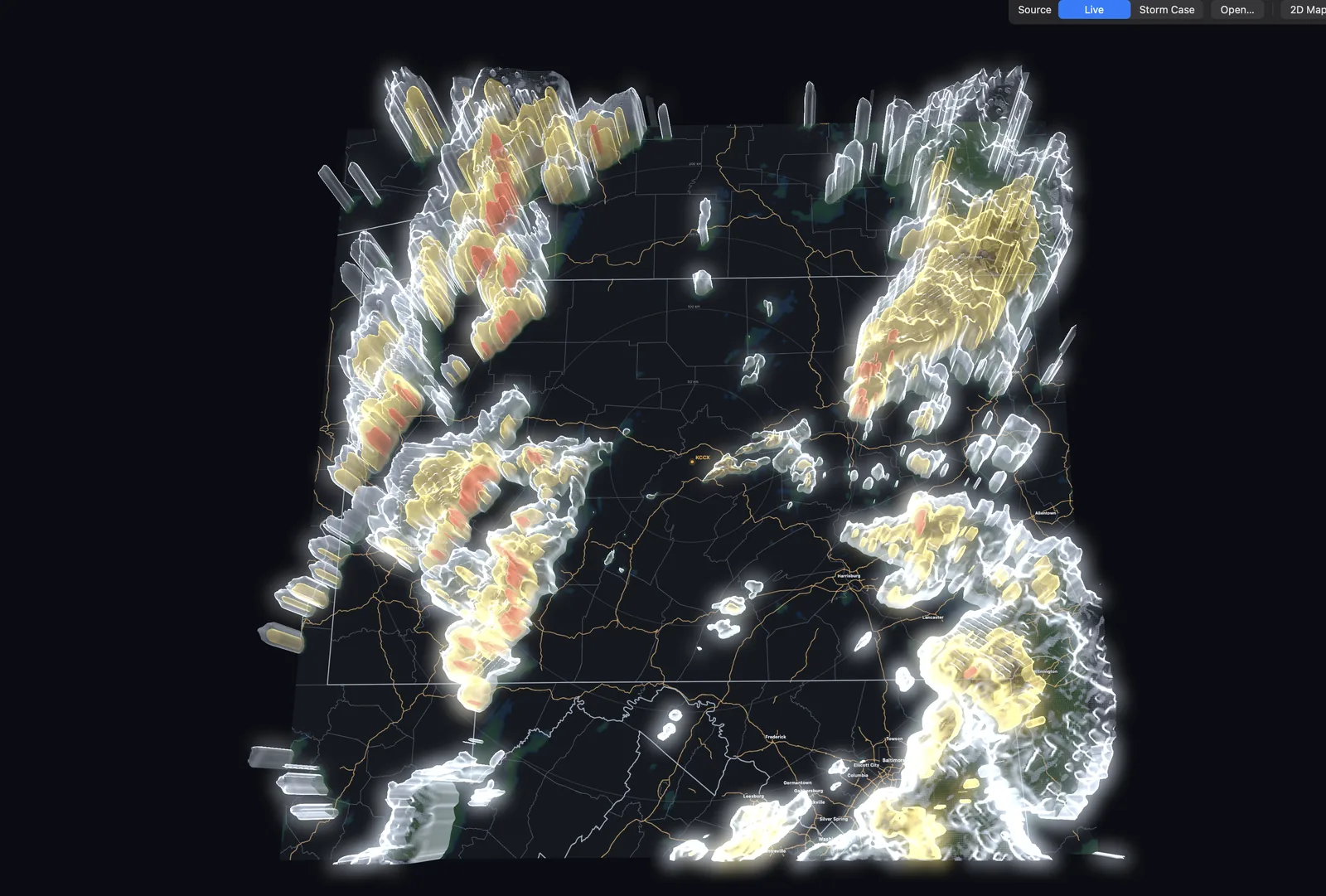
Supercells sit on a spectrum of precipitation efficiency.
- Classic — the textbook arrangement: clear hook, visible mesocyclone, well-separated updraft and precipitation regions.
- High-precipitation (HP) — the mesocyclone is wrapped in rain and the hook may be filled in. These are among the most dangerous storms to be near, because a tornado can be completely invisible from the ground. Velocity and dual-pol matter most here, since reflectivity alone will not show you the circulation.
- Low-precipitation (LP) — little precipitation, sometimes a striking visual structure and a weak radar presentation. Common on the high plains. A storm that looks unimpressive on radar can still be a supercell.
Next: squall lines, bow echoes and derechos — the linear mode, which does most of the damage over far more ground.